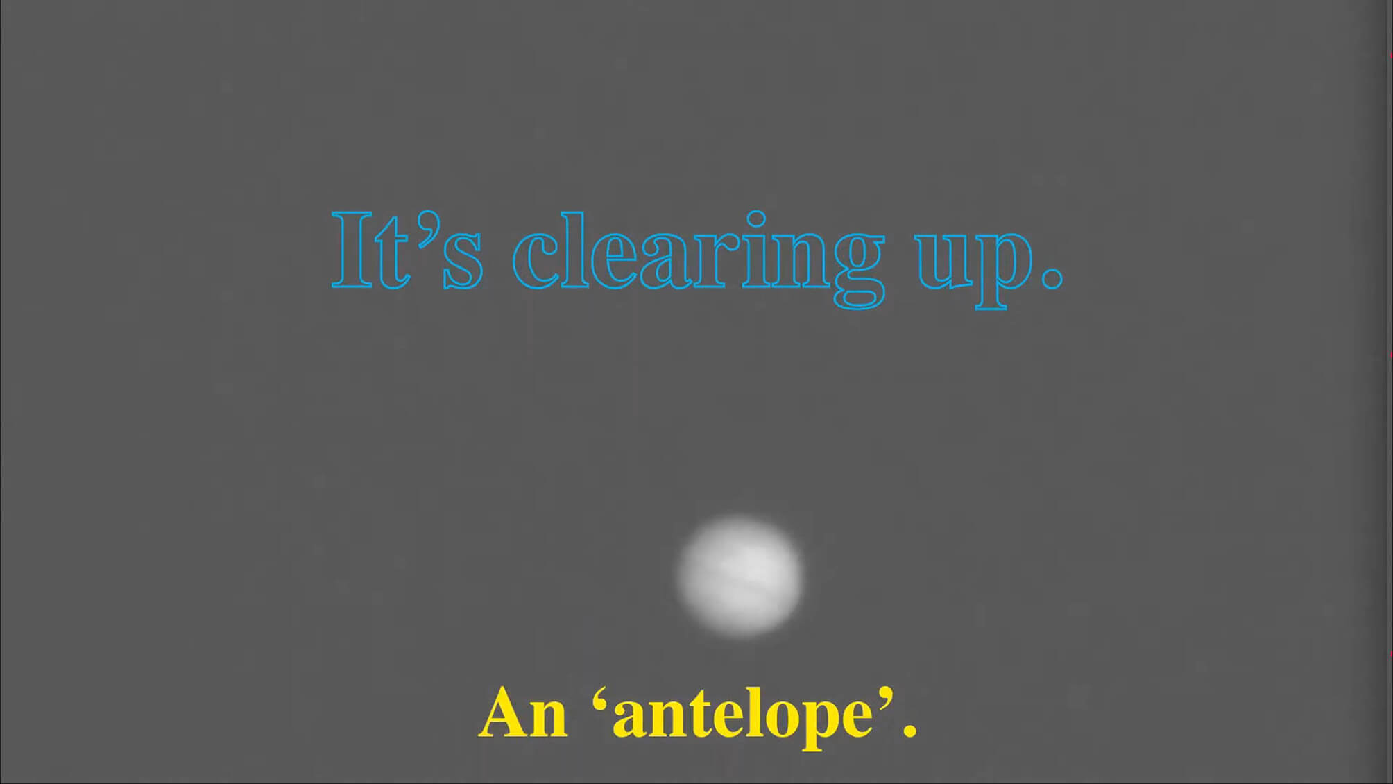
What constitutes a ‘document’ and how does it function?
According to the Oxford English Dictionary, the etymological origin is the Latin ‘documentum’, meaning ‘lesson, proof, instance, specimen’. As a verb, it is ‘to prove or support (something) by documentary evidence’, and ‘to provide with documents’. The online version of the OED includes a draft addition, whereby a document (as a noun) is ‘a collection of data in digital form that is considered a single item and typically has a unique filename by which it can be stored, retrieved, or transmitted (as a file, a spreadsheet, or a graphic)’. The current use of the noun ‘document’ is defined as ‘something written, inscribed, etc., which furnishes evidence or information upon any subject, as a manuscript, title-deed, tomb-stone, coin, picture, etc.’ (emphasis added).
Both ‘something’ and that first ‘etc.’ leave ample room for discussion. A document doubts whether it functions as something unique, or as something reproducible. A passport is a document, but a flyer equally so. Moreover, there is a circular reasoning: to document is ‘to provide with documents’. Defining (the functioning of) a document most likely involves ideas of communication, information, evidence, inscriptions, and implies notions of objectivity and neutrality – but the document is neither reducible to one of them, nor is it equal to their sum. It is hard to pinpoint it, as it disperses into and is affected by other fields: it is intrinsically tied to the history of media and to important currents in literature, photography and art; it is linked to epistemic and power structures. However ubiquitous it is, as an often tangible thing in our environment, and as a concept, a document deranges.
the-documents.org continuously gathers documents and provides them with a short textual description, explanation,
or digression, written by multiple authors. In Paper Knowledge, Lisa Gitelman paraphrases ‘documentalist’ Suzanne Briet, stating that ‘an antelope running wild would not be a document, but an antelope taken into a zoo would be one, presumably because it would then be framed – or reframed – as an example, specimen, or instance’. The gathered files are all documents – if they weren’t before publication, they now are. That is what the-documents.org, irreversibly, does. It is a zoo turning an antelope into an ‘antelope’.
As you made your way through the collection,
the-documents.org tracked the entries you viewed.
It documented your path through the website.
As such, the time spent on the-documents.org turned
into this – a new document.
This document was compiled by ____ on 31.03.2022 23:01, printed on ____ and contains 38 documents on _ pages.
(https://the-documents.org/log/31-03-2022-3945/)
the-documents.org is a project created and edited by De Cleene De Cleene; design & development by atelier Haegeman Temmerman.
the-documents.org has been online since 23.05.2021.
- De Cleene De Cleene is Michiel De Cleene and Arnout De Cleene. Together they form a research group that focusses on novel ways of approaching the everyday, by artistic means and from a cultural and critical perspective.
www.decleenedecleene.be / info@decleenedecleene.be - This project was made possible with the support of the Flemish Government and KASK & Conservatorium, the school of arts of HOGENT and Howest. It is part of the research project Documenting Objects, financed by the HOGENT Arts Research Fund.
- Briet, S. Qu’est-ce que la documentation? Paris: Edit, 1951.
- Gitelman, L. Paper Knowledge. Toward a Media History of Documents.
Durham/ London: Duke University Press, 2014. - Oxford English Dictionary Online. Accessed on 13.05.2021.

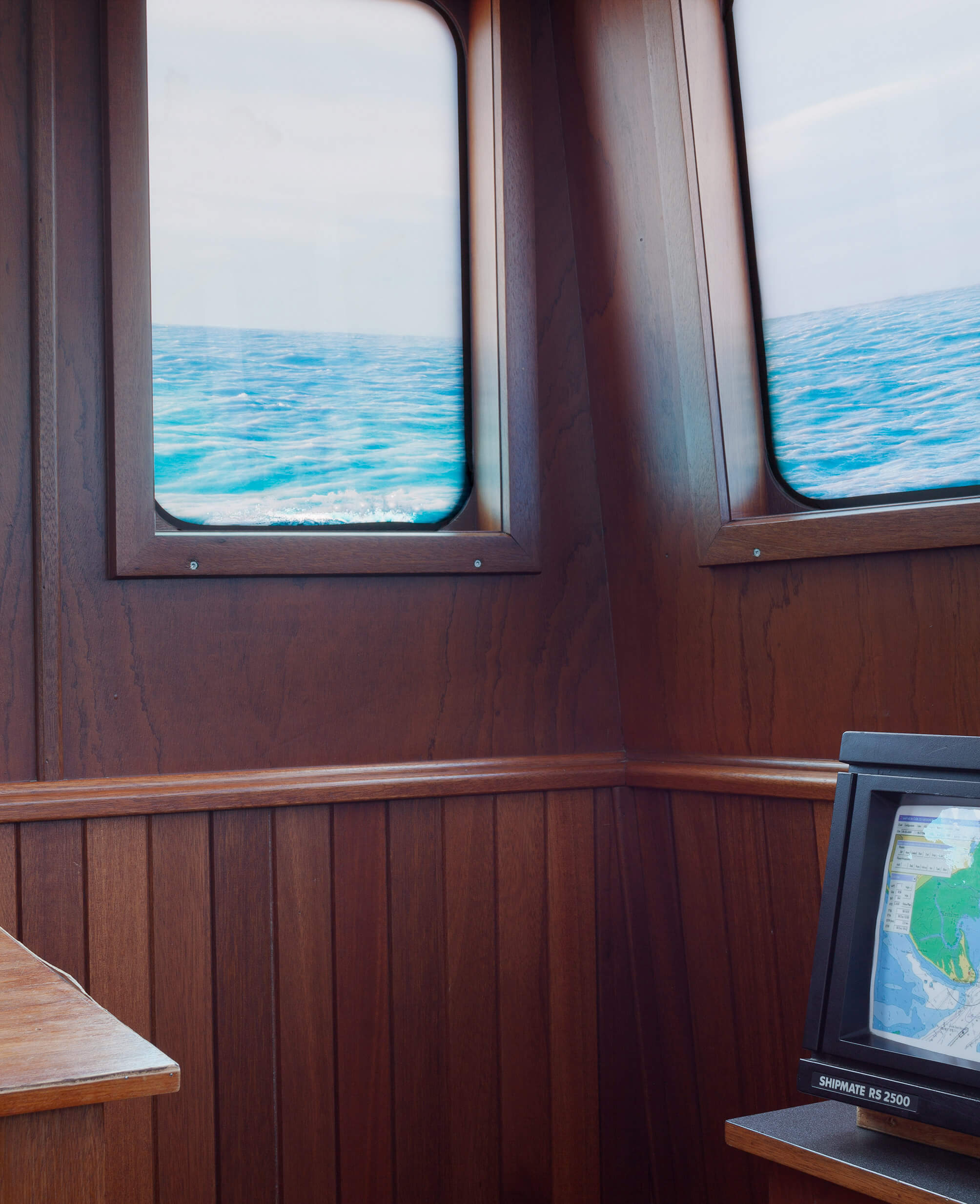
The GPS-plotter displays the ship near Keyhaven Lake, indefinitely. The sea appears calm, the horizon is level from one perspective.
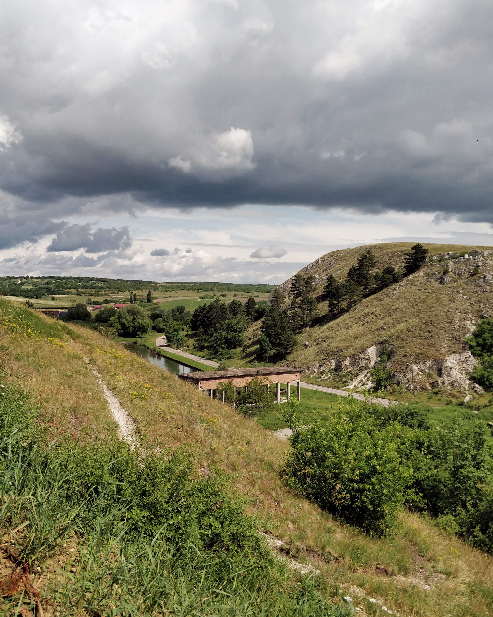
During the 1950s, as part of the communist reconstruction, a large coal/gas power plant was built close to the village of Inota, Hungary. This is the place where I grew up. It operated until about 1994. In the run-up to the final shutdown of the operation they gradually lowered its output. By this time the coal mines in the neighboring city had shut down as well due to the diminishing yield of the low-quality brown coal they had mined for the purpose of fueling the power plant. This resulted in mass unemployment and general decline in the area. The small lake in the photo is an artificial reservoir that collected all the water from the nearby streams. The substantial flow of one of those rivers powered about 11 water-driven flour mills; I know this on account of my grandmother, who would often pick up bags of flour for bread.
The ruin in the photograph once was a pumping facility that drove the water from the lake to the power plant about 3 kilometres away. In the years following the systemic change of Hungary and its celebrated evolution towards a western-type capitalism in ‘89-’90, the rules of ownership and the perception of public and private property were somewhat elusive. The lack of state control resulted in a transfer of public property to private hands on a monumental scale throughout the whole country, and – by extension – the Eastern Bloc. At the time some of the village dwellers of Inota, driven by the force of a major change and the prospect of a new, prosperous future of capitalist entrepreneurship, gathered to disassemble the water-pumping facility along the artificial lake. Slowly, day by day, under the mist of this elusive moment, they carried away carriageful after carriageful of bricks, disassembled from the facade of the building. It was perhaps a way of taking revenge, but certainly also claiming the moment’s opportunity. The bricks made their way into the walls of the new-built family homes of some of the villagers. The former water pumping facility became a sort of material reservoir for the construction of a new future. The transformation from a water reservoir to a material (and ideological) one and its subsequent exhaustion, left a ruin that has remained untouched for the last 30 years. The bricks that were difficult to reach were left in place, thus forming a curtain around the upper part of the building just above the pillars. Freed from all perimeter walls, the leftover structure appeared as a pavilion-like, open floor plan.
The cliffs at the sides of the valley on the photo served as the location for the film My Way Home (Így Jöttem, 1965) by the iconic Hungarian filmmaker Miklós Jancsó, about a 17-year-old boy who falls prisoner to the Russian army and forms a friendship with one of the foes. The film is said to display all the main themes of the director: the psychological presence of landscape, the randomness of violence and the arbitrary nature of power.
In the distance a formation of meadows can be seen in the photograph. Those meadows make up 16 acres of land that were given to my grandfather and subsequently inherited by my mother. It was a reparation for having been stripped of their wealth by the Soviet establishment in the 1950s. The worth of the land is a couple thousand euros as of today. It is part of the largest consistent nature reserve area of the EU.
While standing on the cliffs and looking south-eastward, the power plant can be seen. The orientation of the photograph is approximately north facing.
Turning southwards one can see the stone cellar, about a kilometre away, where my grandfather’s adolescent sister had spent more than a year, while two German SS officers occupied their family home. During the advancement of the Red Army, a Russian soldier, entering the cellar, attempted to take advantage of her. The soldier’s superior intervened and shot him in the head without hesitation. My parents store potatoes and apples in the cellar to keep them from rotting in the summer and freezing in the winter. It is easy to say when a potato or an apple comes from the cellar; it has an unmistakable, musty taste.
Márk Redele pursues projects that fundamentally relate to architecture and its practice but rarely look like architecture. www.markredele.com
Fairly detailed map of the two major marble quarries on the island of Tinos, Greece. The spontaneous route-advice was prepared by a local marble worker, P.D., in the Karia region of the island on a locally extracted, green marble slab. The waved lines represent roads traversing uphill, while the straight lines represent roads following a contour line of the topography.
‘Tell your friend that the wine is for girls; it’s very sweet,’ the marble worker alerted my travel companion K.S. after offering us local sweet wine. The workshop smelled like boiled meat and bones.
Notes on map from left to right, top to bottom:
- Towards Vathi
- Quarry
- incomprehensible
- Towards Vathi Bleu
- Isternia
- Pirgos
Márk Redele pursues projects that fundamentally relate to architecture and its practice but rarely look like architecture. www.markredele.com

During the 1950s, as part of the communist reconstruction, a large coal/gas power plant was built close to the village of Inota, Hungary. This is the place where I grew up. It operated until about 1994. In the run-up to the final shutdown of the operation they gradually lowered its output. By this time the coal mines in the neighboring city had shut down as well due to the diminishing yield of the low-quality brown coal they had mined for the purpose of fueling the power plant. This resulted in mass unemployment and general decline in the area. The small lake in the photo is an artificial reservoir that collected all the water from the nearby streams. The substantial flow of one of those rivers powered about 11 water-driven flour mills; I know this on account of my grandmother, who would often pick up bags of flour for bread.
The ruin in the photograph once was a pumping facility that drove the water from the lake to the power plant about 3 kilometres away. In the years following the systemic change of Hungary and its celebrated evolution towards a western-type capitalism in ‘89-’90, the rules of ownership and the perception of public and private property were somewhat elusive. The lack of state control resulted in a transfer of public property to private hands on a monumental scale throughout the whole country, and – by extension – the Eastern Bloc. At the time some of the village dwellers of Inota, driven by the force of a major change and the prospect of a new, prosperous future of capitalist entrepreneurship, gathered to disassemble the water-pumping facility along the artificial lake. Slowly, day by day, under the mist of this elusive moment, they carried away carriageful after carriageful of bricks, disassembled from the facade of the building. It was perhaps a way of taking revenge, but certainly also claiming the moment’s opportunity. The bricks made their way into the walls of the new-built family homes of some of the villagers. The former water pumping facility became a sort of material reservoir for the construction of a new future. The transformation from a water reservoir to a material (and ideological) one and its subsequent exhaustion, left a ruin that has remained untouched for the last 30 years. The bricks that were difficult to reach were left in place, thus forming a curtain around the upper part of the building just above the pillars. Freed from all perimeter walls, the leftover structure appeared as a pavilion-like, open floor plan.
The cliffs at the sides of the valley on the photo served as the location for the film My Way Home (Így Jöttem, 1965) by the iconic Hungarian filmmaker Miklós Jancsó, about a 17-year-old boy who falls prisoner to the Russian army and forms a friendship with one of the foes. The film is said to display all the main themes of the director: the psychological presence of landscape, the randomness of violence and the arbitrary nature of power.
In the distance a formation of meadows can be seen in the photograph. Those meadows make up 16 acres of land that were given to my grandfather and subsequently inherited by my mother. It was a reparation for having been stripped of their wealth by the Soviet establishment in the 1950s. The worth of the land is a couple thousand euros as of today. It is part of the largest consistent nature reserve area of the EU.
While standing on the cliffs and looking south-eastward, the power plant can be seen. The orientation of the photograph is approximately north facing.
Turning southwards one can see the stone cellar, about a kilometre away, where my grandfather’s adolescent sister had spent more than a year, while two German SS officers occupied their family home. During the advancement of the Red Army, a Russian soldier, entering the cellar, attempted to take advantage of her. The soldier’s superior intervened and shot him in the head without hesitation. My parents store potatoes and apples in the cellar to keep them from rotting in the summer and freezing in the winter. It is easy to say when a potato or an apple comes from the cellar; it has an unmistakable, musty taste.
Márk Redele pursues projects that fundamentally relate to architecture and its practice but rarely look like architecture. www.markredele.com

K. says that the stall where he usually buys fruit has already been packed up. But he is not worried about the quality of the fruit the other vendor sells. He gestures encouragingly.
Five signs of type-1, eleven of type-2 and two of type-3 are visible. Four of type-2 (two visible, two deduced) and two of type-3 retain two vehicles.


Márk Redele pursues projects that fundamentally relate to architecture and its practice but rarely look like architecture. www.markredele.com

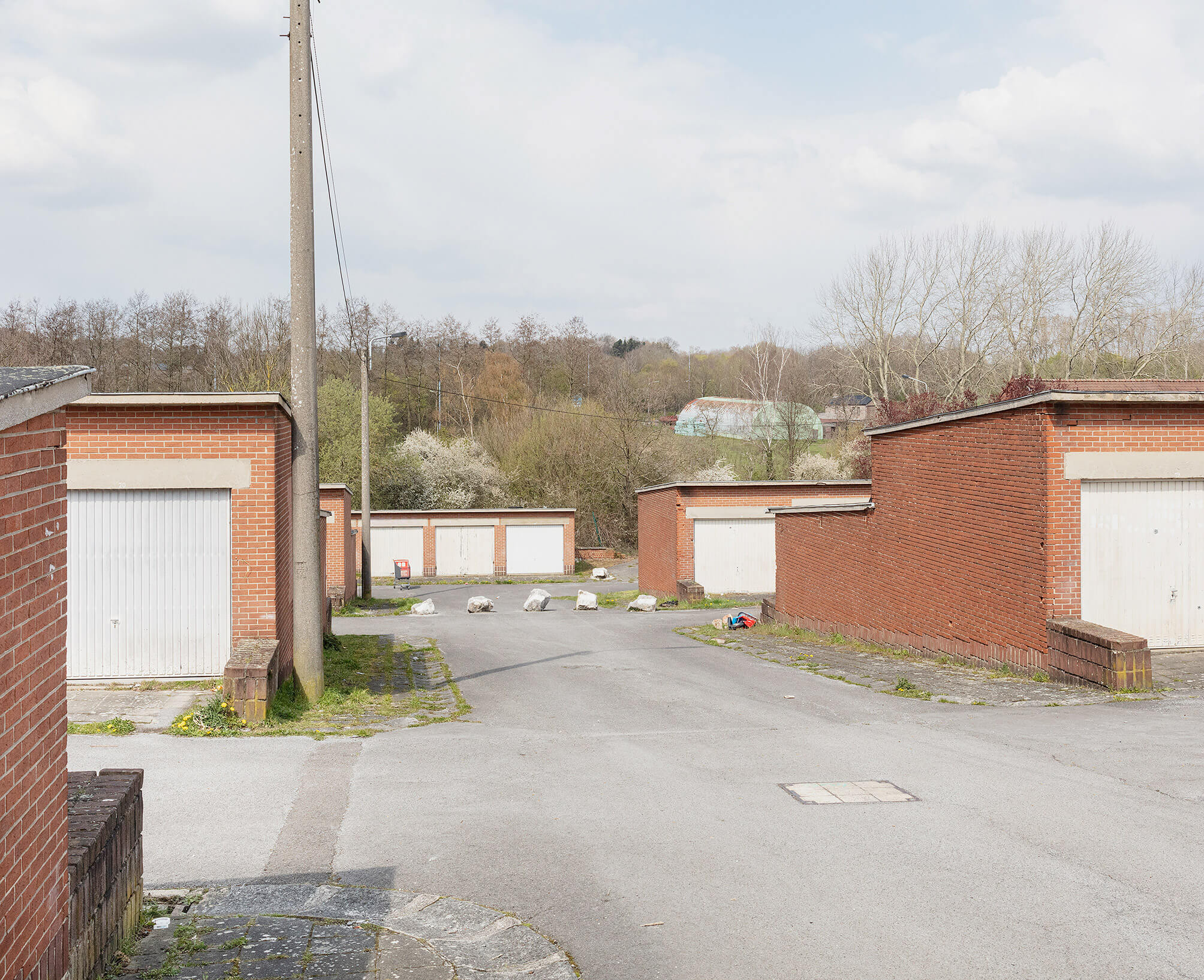
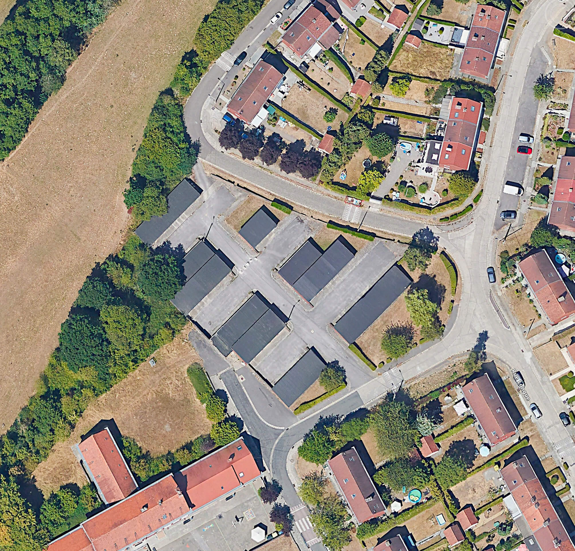
Seven very similar and rudimentary buildings take in a trapezoid plot of land in Gilly. They are located between the school on the Rue Circulaire and the houses along the Rue de l’Abbaye. The structures are built of orange brick, concrete structural elements, whitish steel gates and roofing. Every garage has its own number, hand-painted in white on the concrete lintel above each gate. In summer the roofing gets hot and soft.
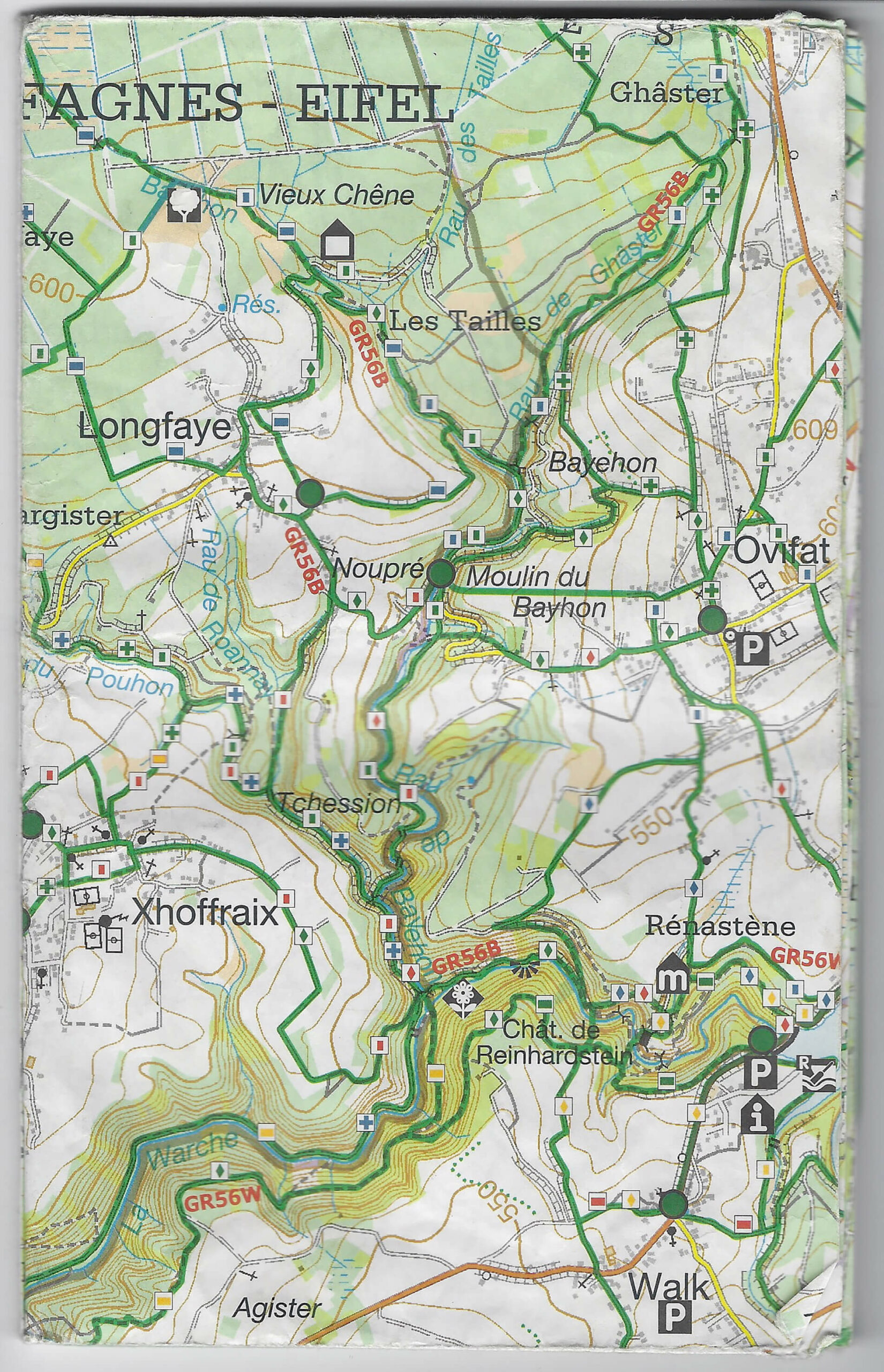
The paths in the valley of the Bayehon are covered with ice. We are making our way down towards the valley of the Ghâster. The temperature is minus 15 degrees Celsius. The water in our drinking bottles is frozen. We are betting on the shelter indicated on the map (Au Pied des Fagnes, Carte De Promenades, 1:25.000, Institut Geographique National) to pitch our tent. There is almost no wind, but every breath of air feels like we’re being hit with a thousand needles. What the map indicates as a shelter appears to be a picnic table.
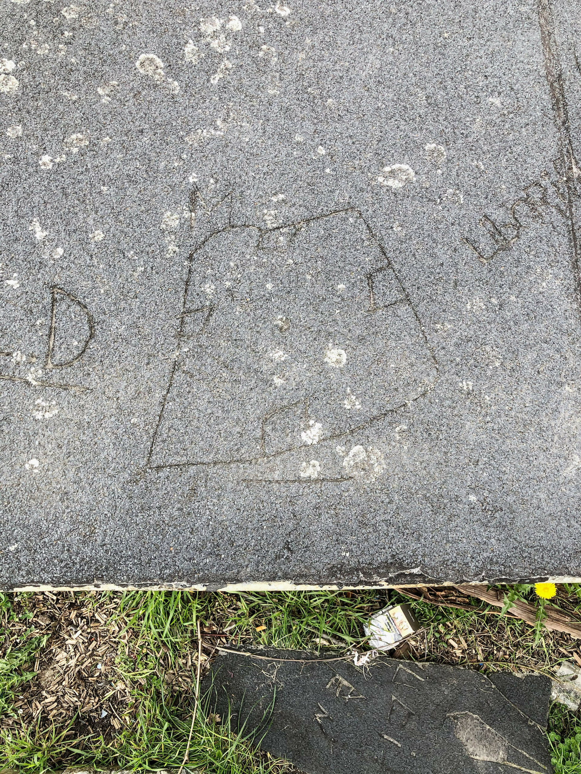
Five white boulders close off a shortcut for motorists who attempt to cut the bend in the road. The southernmost roof’s pitch runs opposite to the landscape’s slope. The lower roofline is, therefore, only about one meter above a small, triangular patch of grass which is hidden from view by a hedge. In summer, when the roofing gets hot and soft, text and drawings get pressed or carved into it.
Google Earth
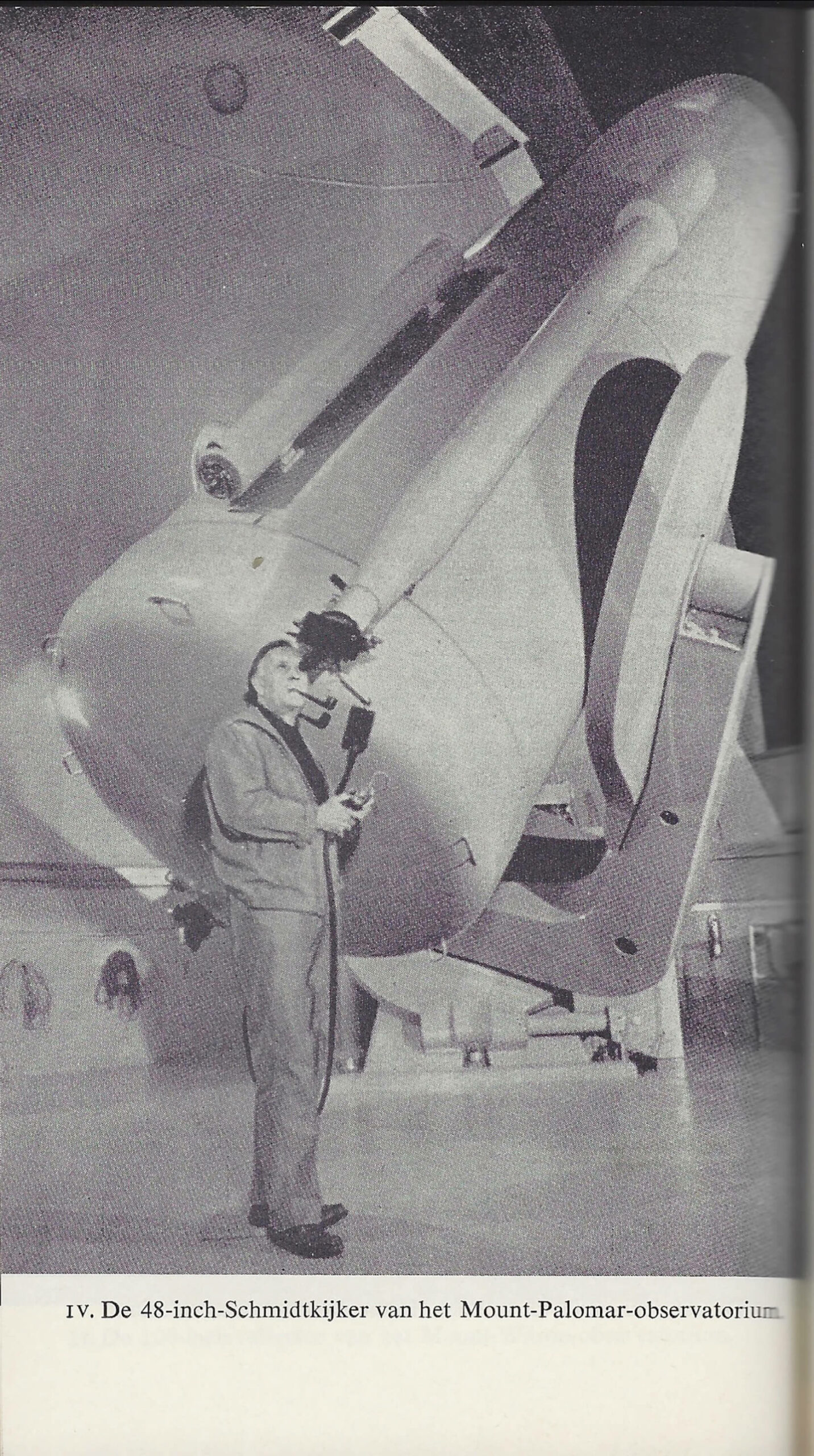
The 48-inch Oschin Schmidt, a renowned reflecting telescope at Palomar Observatory, California, was used for the Palomar Observatory Sky Survey (POSS), published in 1958, one of the largest photographic surveys of the night sky.
Based on the man’s pipe shadow’s direction, thrown onto the telescope, there is reason to believe an off-camera flash was used to make the picture.
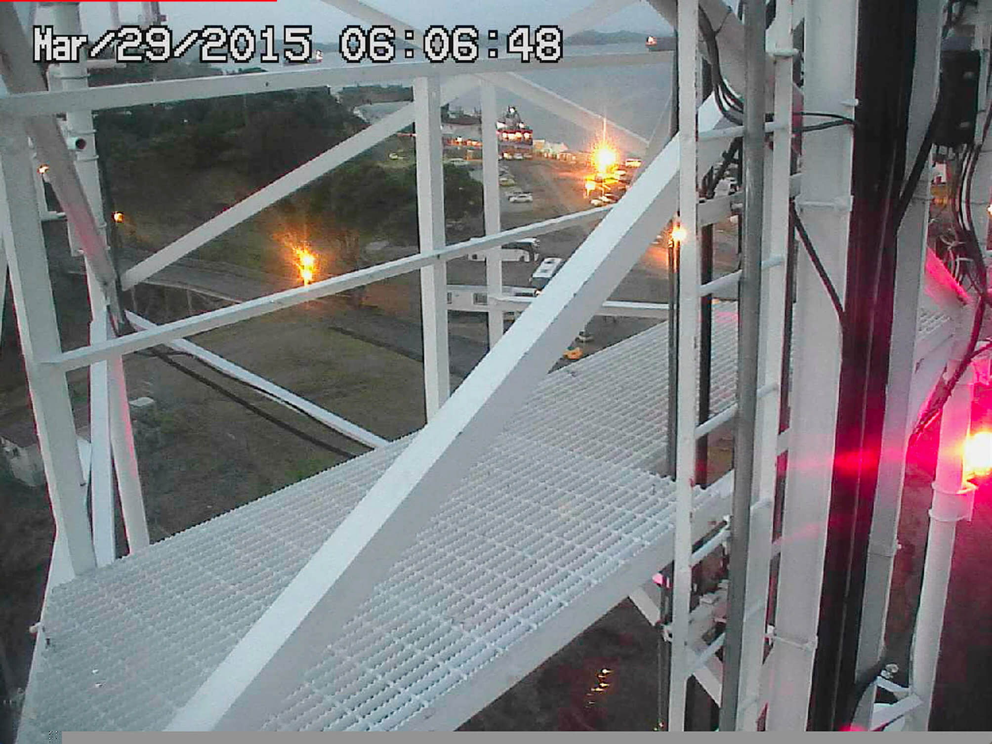
On March 23th 2015, a high pressure system above Panama Bay blew strong winds landwards. At the Gatun locks, one of the webcams overlooking the Canal neglected the traffic and briefly captured its own images. The ship’s presumed passage through the Gatun locks wasn’t recorded by this camera and the AIS-transponder did not save any data of the ship’s transit from the Pacific to the Atlantic side of the canal: the Authenticity managed to swap oceans undetected.
On February 16th 2016, the transponder still signals the ship near the port of Bahia Las Minas. The current is calm, the ship has been practically immobile for a year.
First published in: De Cleene, M. Reference Guide. Amsterdam: Roma Publications, 2019
Webcam Gatun Locks, Panama Canal, http://www.pancanal.com
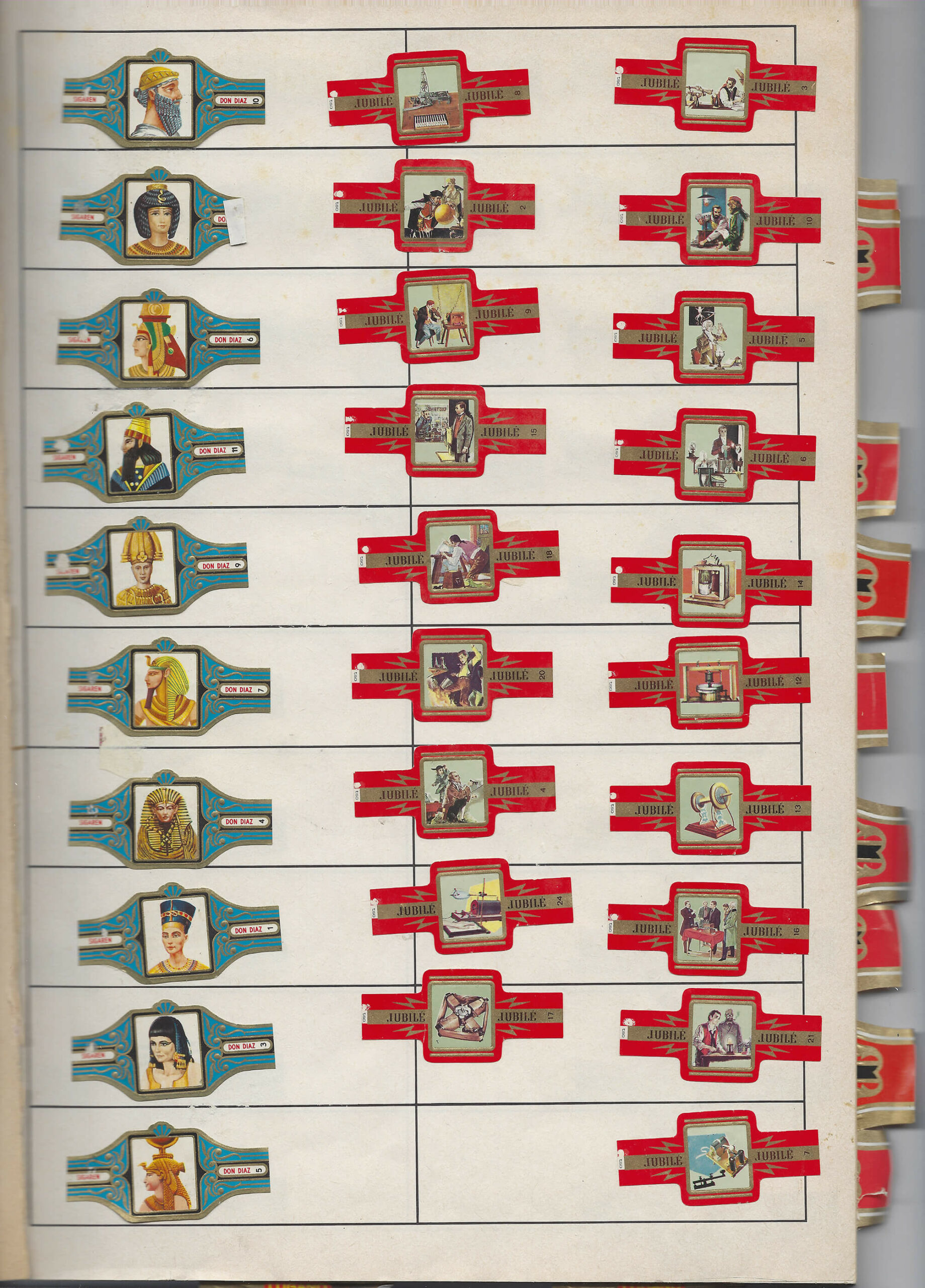
A mostly empty book designed to collect cigar bands. The bands are glued to the paper at their left side, so the information on the backside, explaining the image and referring to the series it belongs to and the number of different labels the series contains, can be looked up. The book has complete and incomplete series on Christopher Columbus (complete), tanks (incomplete), the origins of civilization (complete), Ancient cultures (incomplete), fashion (complete), South-American sculptures (complete), Ancient columns (incomplete), Nobel Prize Winners (incomplete), an unclarified series of seven men, most of whom are ‘prof.’ or ‘dr.’(complete / incomplete), design plates (incomplete), famous Belgians (complete / incomplete), statesmen (incomplete) and football players (incomplete). The first page in the book is used to present two series. The left column presents the Egyptian dynasty (incomplete). The middle and right column present a series of bands by the brand Jubilé on the history of energy in telling scenes and pieces of machinery.
Series: Energy
Middle column, top to bottom:
- The writing telegraph. Hughes
- Experiment with a sulphur globe. William Gilbert
- Primitive telephone. Philipp Reis
- Wireless telegraph.1 Guglielo [sic] Marconi
- The arc of Volta. Sir Humphry Davy
- Fire in the wagon. Thomas Alva Edison
- Experiments with lightning. Benjamin Franklin
- Cathode for creating X-Rays. Wilhelm Röntgen
- Rotating magnetic field. Galileo Ferraris
Right column, top to bottom:
- Electric discharge. William Watt
- Magnetic telephone. Antonio Meucci
- Muscles reacting to electricity. Luigi Galvani
- Voltaic pile. Alessandro Volta
- Oscillating circuit. Guglielo [sic] Marconi
- Development of the telephone. Graham Bell
- Telephone, beginning of the 20th century
- Next to his wireless telegraph. Guglielo [sic] Marconi
- Invention of the incandescent light bulb. Thomas Alva Edison
- Morse’s telegraph. Samuel Morse
The series is incomplete.2
The scene shows a man standing at a desk, sticking out his hand to an officer in a window that reads, in mirror writing: Customs.
On eBay a complete series is advertised (15 EUR), with a lo-res picture of the whole collection, including the five bands missing in my grandfather’s collection. The information on the back, however, is not given. It leads to a highly speculative history of energy.
A man in a gown watching a T-shaped object.
A child in a cellar, sitting on a stool at a table with gray objects.
A soldier kneeling beside a child, in front of a train, and in front of a boat.
A low table with a giant cartwheel of sorts and a box.
A vertical object with what seems to be a bell on top.
On March 23th 2015, a high pressure system above Panama Bay blew strong winds landwards. At the Gatun locks, one of the webcams overlooking the Canal neglected the traffic and briefly captured its own images. The ship’s presumed passage through the Gatun locks wasn’t recorded by this camera and the AIS-transponder did not save any data of the ship’s transit from the Pacific to the Atlantic side of the canal: the Authenticity managed to swap oceans undetected.
On February 16th 2016, the transponder still signals the ship near the port of Bahia Las Minas. The current is calm, the ship has been practically immobile for a year.
First published in: De Cleene, M. Reference Guide. Amsterdam: Roma Publications, 2019
Webcam Gatun Locks, Panama Canal, http://www.pancanal.com

A visit to the Royal Observatory of Belgium, in Ukkel. Most of the domes are damaged and need repairing. Only a few telescopes are in use. It is difficult to find a good spot from which to film the site. When we asked the people at the Royal Meteorological Institute – the Observatory’s neighbouring institution – if we could access their building’s roof to film the observatory, the answer was ‘no’.
I (M.D.C.) remember there was a fire nearby. We couldn’t see the flames, but a tall dark plume of smoke rose above the trees lining the site. We didn’t insist any longer and ceased our attempt to access the roof, hoping we might find a good spot to film the smoke with a dome in the foreground.
Kesteloot, J. Leerboek van Cosmografie voor Middelbaar en Lager Normaal Onderwijs (derde vermeerderde uitgave). Brugge: Firma Karel Beyaert, 1948.

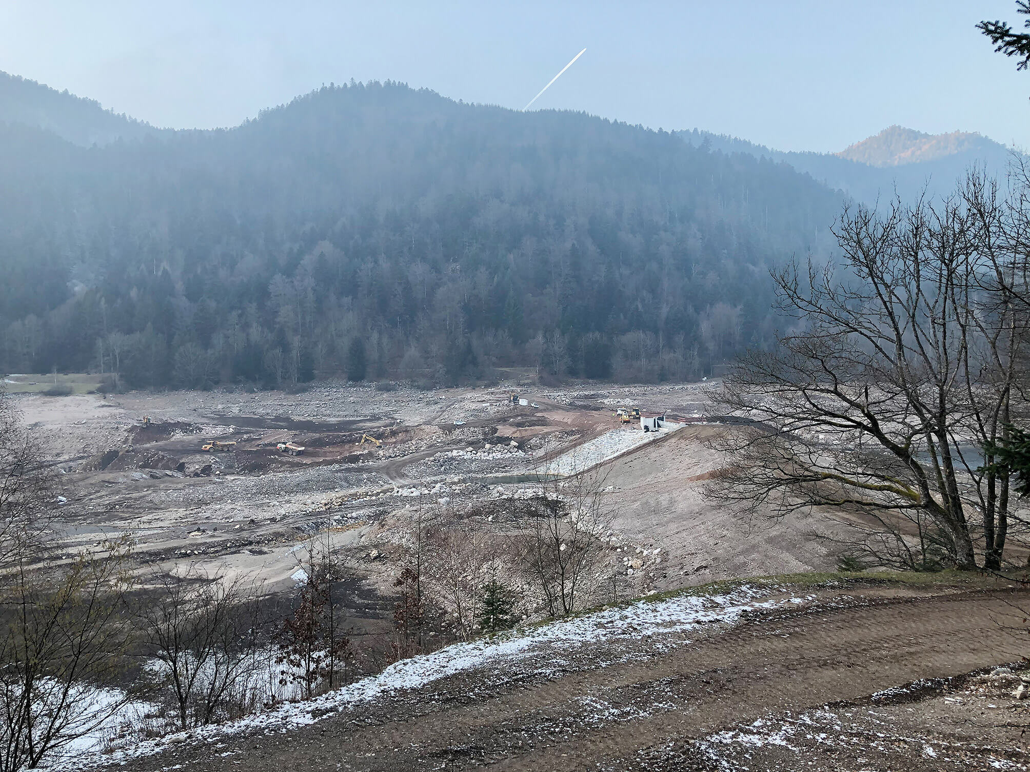
On January 23, 2020 a young couple walks around the drained reservoir of Kruth-Wildenstein.
It’s freezing. They’re expecting their first child within a month.
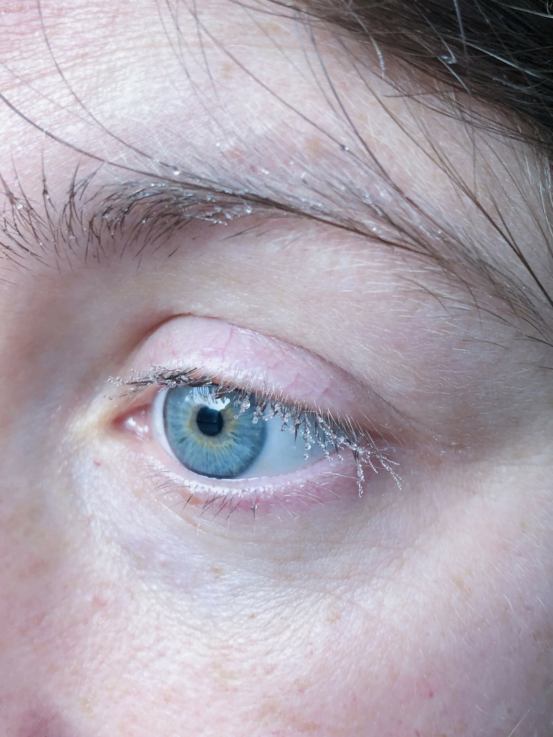
The paths in the valley of the Bayehon are covered with ice. We are making our way down towards the valley of the Ghâster. The temperature is minus 15 degrees Celsius. The water in our drinking bottles is frozen. We are betting on the shelter indicated on the map (Au Pied des Fagnes, Carte De Promenades, 1:25.000, Institut Geographique National) to pitch our tent. There is almost no wind, but every breath of air feels like we’re being hit with a thousand needles. What the map indicates as a shelter appears to be a picnic table.

The river swells and eventually overflows, causing the death of six people and extensive damage: washed away bridges, damaged homes, submerged factories, destroyed food stocks, heavily eroded roads and paths.
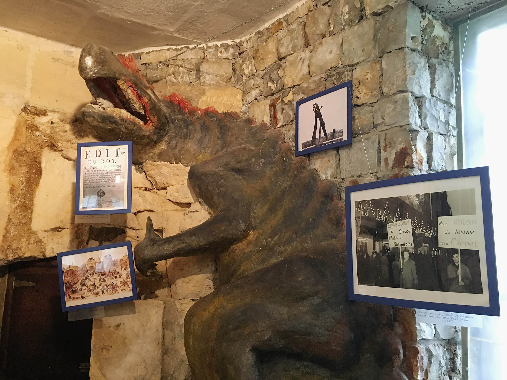
Interior of Eben-Ezer: photocopies and replicas of among other things an Edit du Roy and a photograph of a Marche pour la liberté de conscience, 1956. Handwritten labels are added beneath the blue frames. Due to limited lighting, and an interdiction to use the camera’s flash, some labels are illegible, even when zooming in on the picture. It is unclear what the bottom left replica of a painting is (it has a Brueghelian air to it) and the upper right replica of a photograph.
The walls are made of flint, harvested from quarries in the neighbourhood.
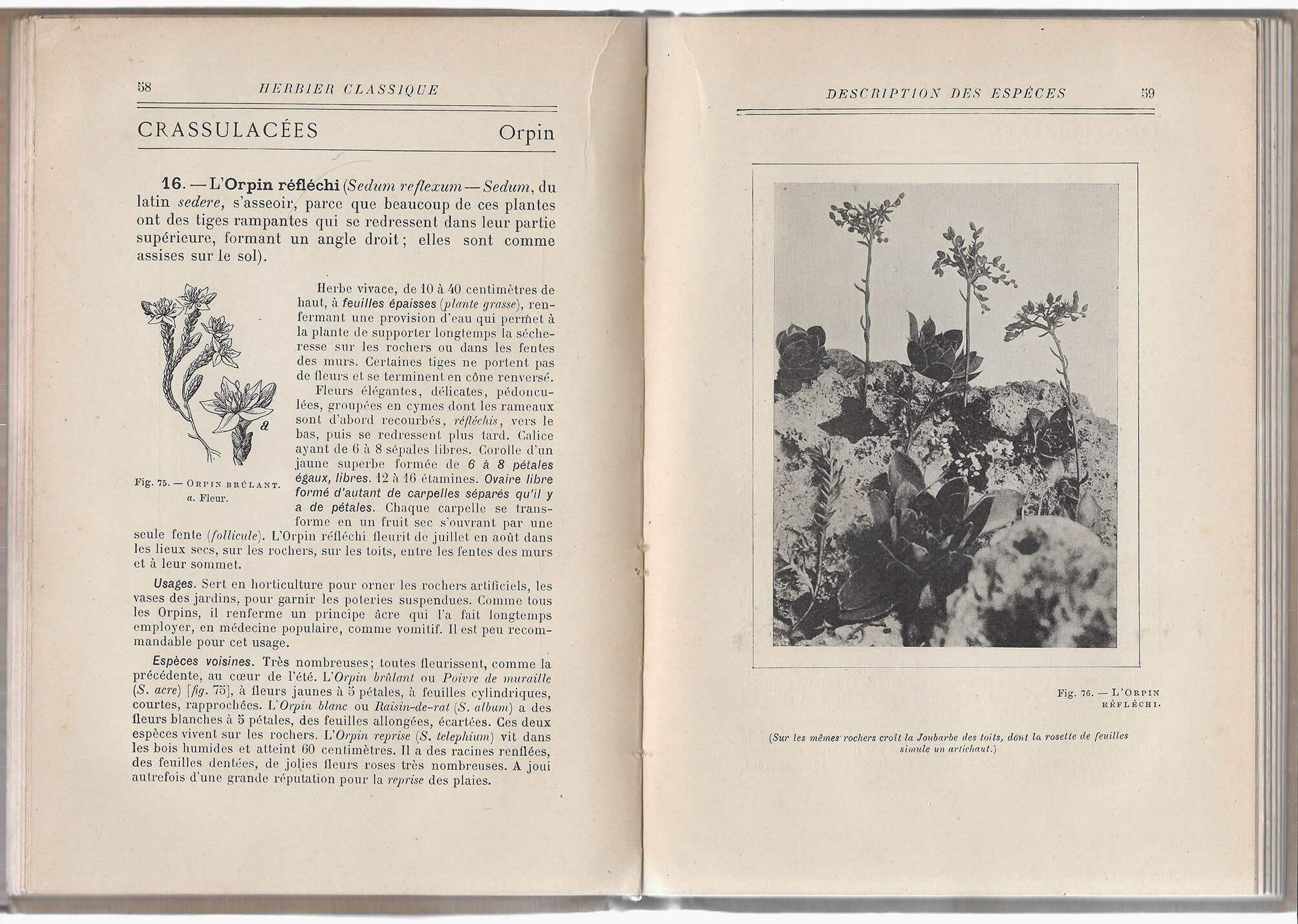
The Sedum reflexum grows on rocky soils and in crevices of walls. In L’herbier classique, it is depicted in two ways, just like the other plants in the book. This double portraiture is important, the author states in the introduction: ‘one consists of the reproductions of the photographs taken by the author of this book […]; the other, drawings made by excellent artists who observed the plants themselves, showing details photography can’t reproduce, highlighting aspects the photographs leave untouched. […] From this double representation, interesting comparisons can be made, highly enlightening from an artistic point of view, between the realistic aspect of nature’s “productions” and the interpretation thereof by the draftsman’ (5).
A detail not covered by the drawing of the sedum reflexum, is the presence of other species in the vicinity of the plant, a detail shown in the photograph and described in the caption: ‘The Common houseleek grows on the same rocks, with its rosette of leaves pretending to be an artichoke’ (59).
(‘Slice of more than three meters in diameter, sawn from a Mammoth-tree, given by California to the botanical garden of New York, and presented there’)
Thiery describes the ‘patriarchs’ of the plant world. This slice of a Sequoia, which fell in 1917 in Yosemite National Park, is 1694 years old. A woman of the New York Botanical Institue, where the slice of the patriarch is presented, counted the rings. If one would look at the picture with a magnifying glass, Thiery writes in a footnote, the reader (with good eyes and a fair amount of knowledge of the English language) would be able to read the labels indicating the important global events the tree witnessed. They are transcribed and translated by the author. The end of the Roman occupation of Great Britain. Columbus arriving in America. The Declaration of Independence. This is a lie: the text is illegible, even when using a magnifier.
In the photograph, the slice, as on view in the New York Botanical Institute, is presented upright. To prevent it from rolling away, two small triangular slices of wood were posited at the left and right side of the slice. The type of wood of these slices, nor the age of the patriarch from which they stem, are known.
Thiery, M. Het woud. Een proeve van plantenaardrijkskunde. Gent: De Garve, s.d., p. 59.

The torn off section of roofing on the grass has part of a text carved in it: ‘UDI’ and ‘EN’ are still legible. It must have come from another roof; the one shown in the photograph has no missing sections, nor visible repairs.
The roofing that is still on the garage shows a drawing of some kind. A floorplan for a squarish building with a supporting column along each side, or the layout for a tactical explanation, perhaps.
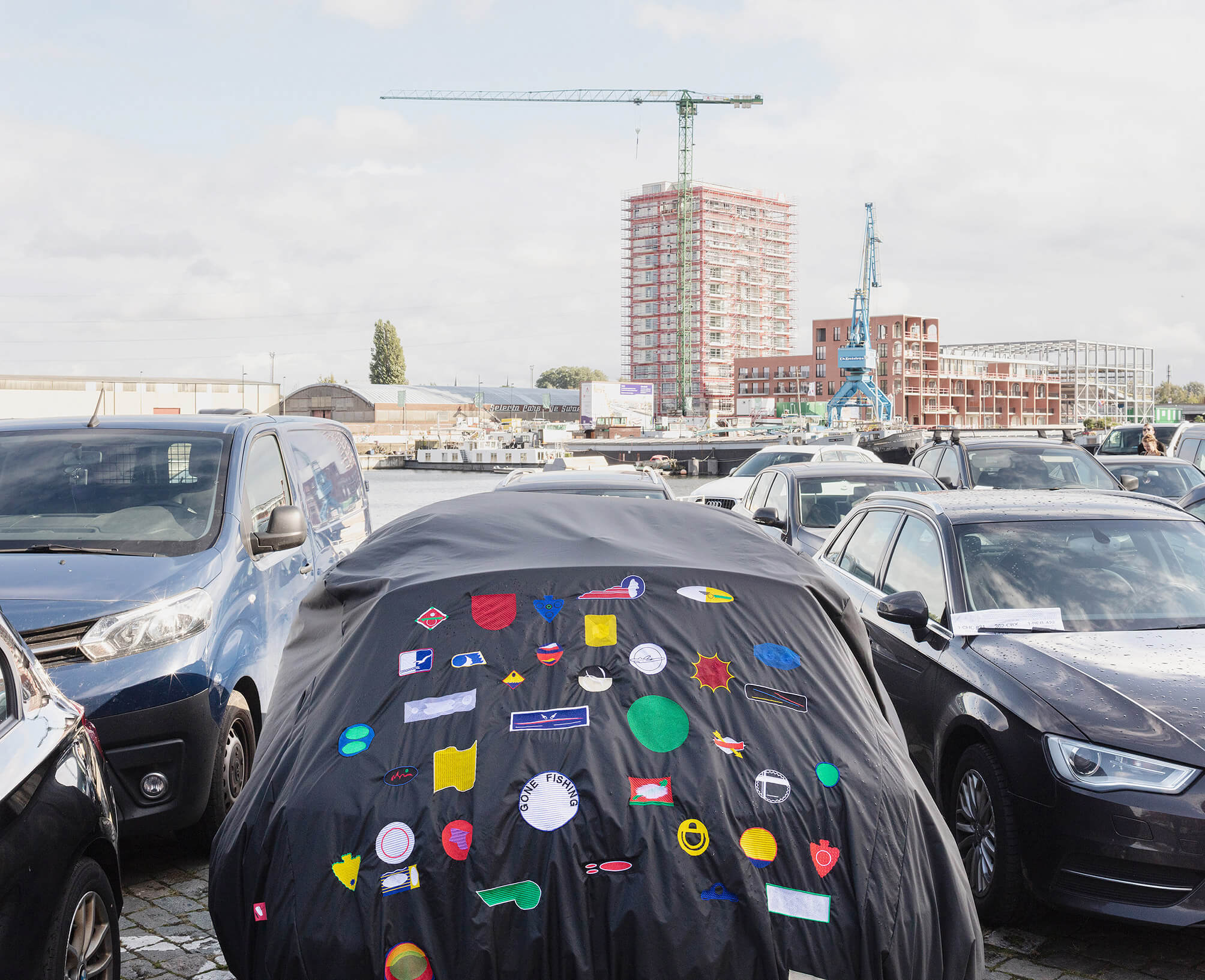
A year before the crash, Swiss artist Charlotte Stuby designed a tailor-made cover for the car. The dents caused by the unfortunate hailstorm weren’t visible. The work, called Gone Fishing, was on view during an open air exhibition on the theme of the parking lot. Heavy wind had caused the temporary traffic signs on the parking lot, left there by the city services, to tip over. One hit a car and caused a scratch. It was unclear if this would be something the insurance company would accept. We attached Stuby’s cover a second time. Parking fines flew irregularly across the lot.
As a result of intense drainage of drinking water, an area around the Belgian city of Waver was designated as having a potential for land subsidence – the downward movement of the soil over an extended period of time. People in Waver were startled to find their town mentioned in an international study published in Science. Flemish newspaper De Standaard uncovered that the researchers had used an older study, published in 2005, which claimed that the soil in Waver had moved some five centimeters in a period of eleven years. Pictures of fissures in Waver-facades had been added to the original article.
Last year, cracks in our living room wall were covered up by placing plasterboard in front of the plastered brick wall. As such, we avoided having to paint the wall with the cracks and the marks left by the IKEA Billy bookcases.
https://science.sciencemag.org/content/sci/suppl/2020/12/29/371.6524.34.DC1/abb8549_Herrera_SM.pdf
https://www.standaard.be/cnt/dmf20210106_97889104
http://earth.esa.int/fringe2005/proceedings/papers/677_devleeschouwer.pdf

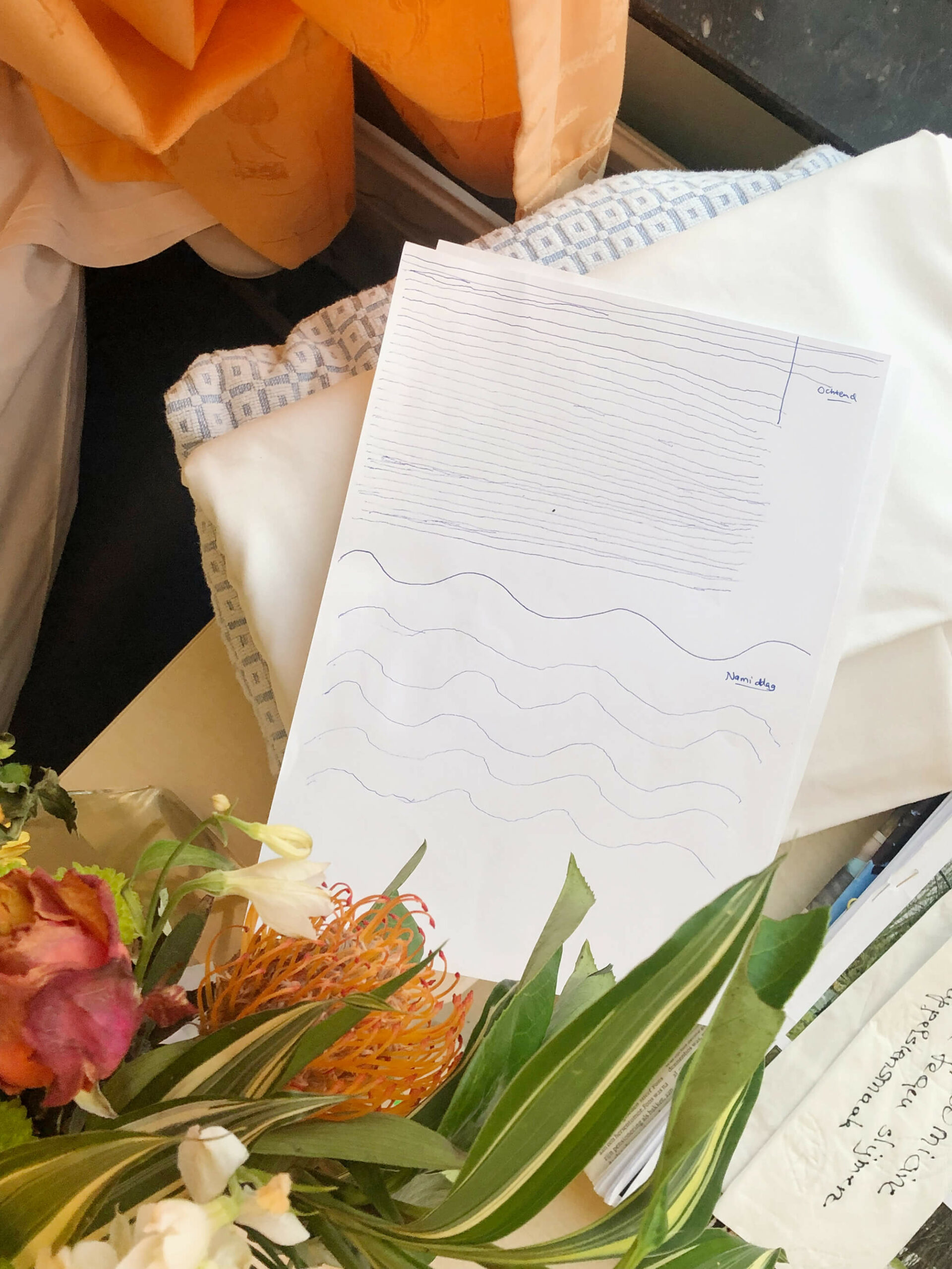
On a pile of fresh hospital sheets, near the radiator, the tangerine curtains and the black marble window sill (the window looks out over the parking lot), underneath the two-day-old bouquet of flowers and next to a pile of magazines with a handwritten note on top (about a syrup that relieves slime and tastes like oranges), lie two sheets of paper.
Earlier that day the physiotherapist had come by. Twice. Once in the morning and once in the afternoon. He had each time drawn the first line, as an example. A straight line in the morning, a curvy line in the afternoon.
With a ballpoint pen my grandfather, who is recovering from an accident, diligently copied the examples (31 in the morning, 5 in the afternoon).
Shortly after crossing the Thur the couple reaches their car. They’re freezing. As the sun sets they drive through the mountainous landscape. The heating hurts their fingers.
The next day, they return, but the scene looks different. It’s warmer. The Thur appears to flow faster.

The river swells and eventually overflows, causing the death of six people and extensive damage: washed away bridges, damaged homes, submerged factories, destroyed food stocks, heavily eroded roads and paths.

On Wednesday, May 9, 2018 at 2:23:14 PM Koh Elaine starts the thread original or original copy on the The Free Dictionary by Farlex’s forum.
‘Is “original copy” correct or should it be “original”? Thanks.’
The seventh reply to Elaine’s question is Wilmar’s on Thursday (his was preceded by towan52, georgew, NKM, Koh Elaine, Sarrriesfan, ChrisKC, Ashwin Joshi).
‘An original copy IS the original.
Folks usually call the document first created the original, but some will say original copy. If I run that original thru the copy machine, I end up with two copies (yes, I said copies) of the same thing – the original and the duplicate of it (in terms of content). This is how the term is commonly used.
If your writing or conversation depends heavily on understand the difference, I would recommend using the terms original and duplicates. There are many times when that is very important, in that the original must be retained by a particular party, and the duplicates are marked as such and distributed or stored as required depending on the document and the circumstance.
If you are just trying to make sure that you have enough copies to distribute to everyone at the company meeting this afternoon, use whatever terms trips your trigger. But, if you want to ensure that you keep custody of the original, so that you can make additional duplicates (copies) when additional people attend, then be more specific about the words you use.
OH, and, please, in the future, include some context with your question. Asking if “word” is correct doesn’t go very far in supplying a reasonably useful response.’
https://forum.thefreedictionary.com/postst182102_original-or-original-copy.aspx

The paths in the valley of the Bayehon are covered with ice. We are making our way down towards the valley of the Ghâster. The temperature is minus 15 degrees Celsius. The water in our drinking bottles is frozen. We are betting on the shelter indicated on the map (Au Pied des Fagnes, Carte De Promenades, 1:25.000, Institut Geographique National) to pitch our tent. There is almost no wind, but every breath of air feels like we’re being hit with a thousand needles. What the map indicates as a shelter appears to be a picnic table.

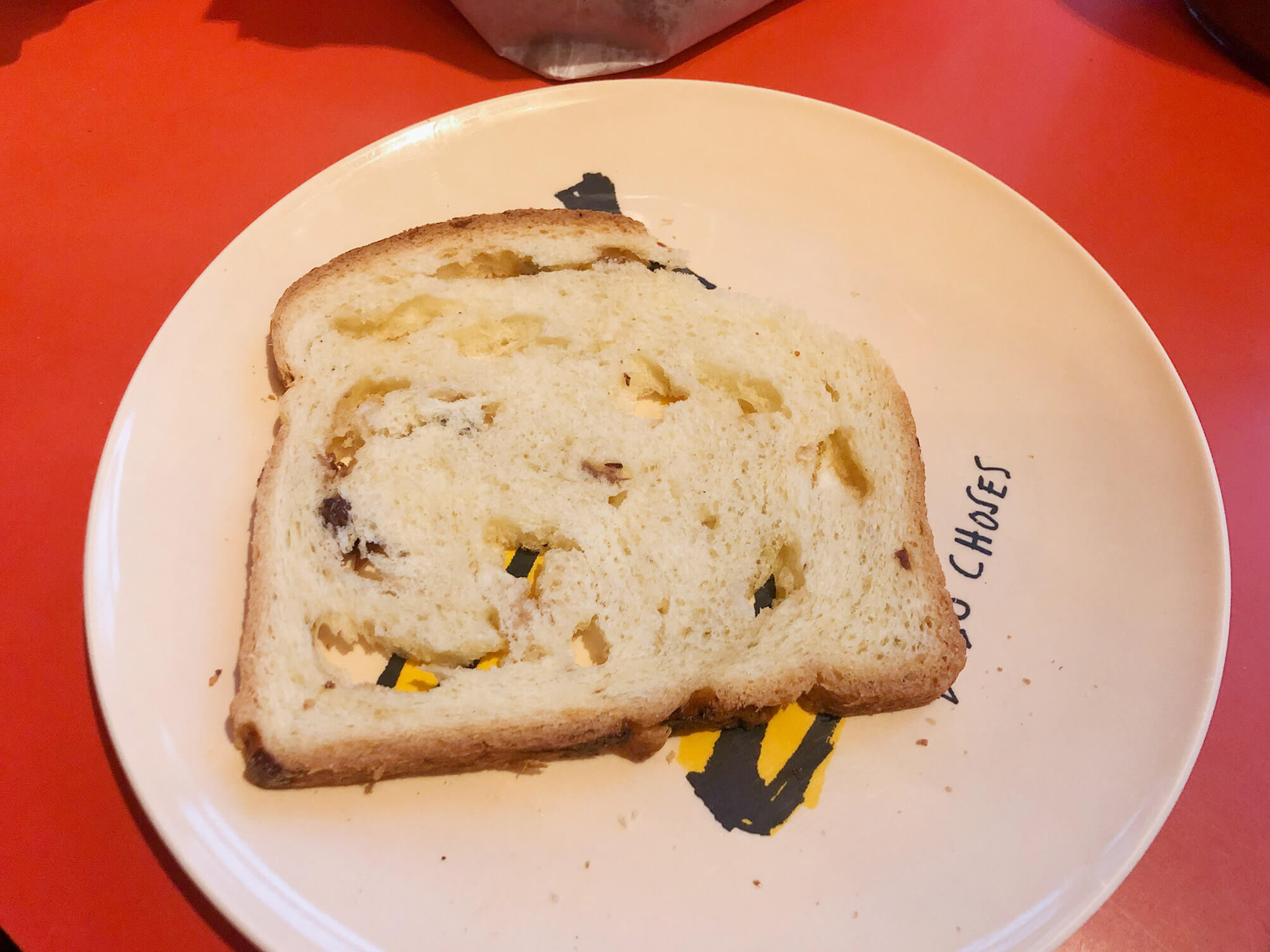
When I grew up, my parents told me that the number of raisins in the local baker’s raisin bread attested to the result of the most recent soccer match of KAA Gent. A victory was celebrated by throwing more raisins into the dough than usual, a loaf following a painful loss was hardly a raisin bread at all.
The baker retired long ago. Today my two-year-old son picked out all the raisins from his slice of bread. KAA Gent’s last game was a tie against Union.
Depending on the language one chooses, the Wikipedia entry for ‘document’ shows a different picture. The French-language page shows what appears to be a Slovenian thesis written in 1984. The caption states it is a ‘book of Czechoslovak computer science author Květoslav Šoustal about computer networks’. The image was uploaded by Kelovy, a Slovakian mushroom-picker.
The anonymous hand rests on a lemon-yellow tablecloth, on which a yellow book and a blue binded file lie. The top left corner is the most intriguing, however: the tablecloth seems to be draped over a lemon, alongside a drinking glass. The cloth, however, does not get shaped by the lemon. Nor does the shadow-side of the lemon coincide with the shadow the other documents throw on the tablecloth. A closer look seems to indicate that the lemon is in fact an image of a lemon, printed on a plastic napkin.
The Russian wikipedia shows the image of a lease agreement. The German wikipedia for ‘document’ is text only.
https://fr.wikipedia.org/wiki/Document#/media/Fichier:KVETOSLAV_SOUSTAL_BOOK.JPG, created October 3, 2006 / original in original: paper, 1984

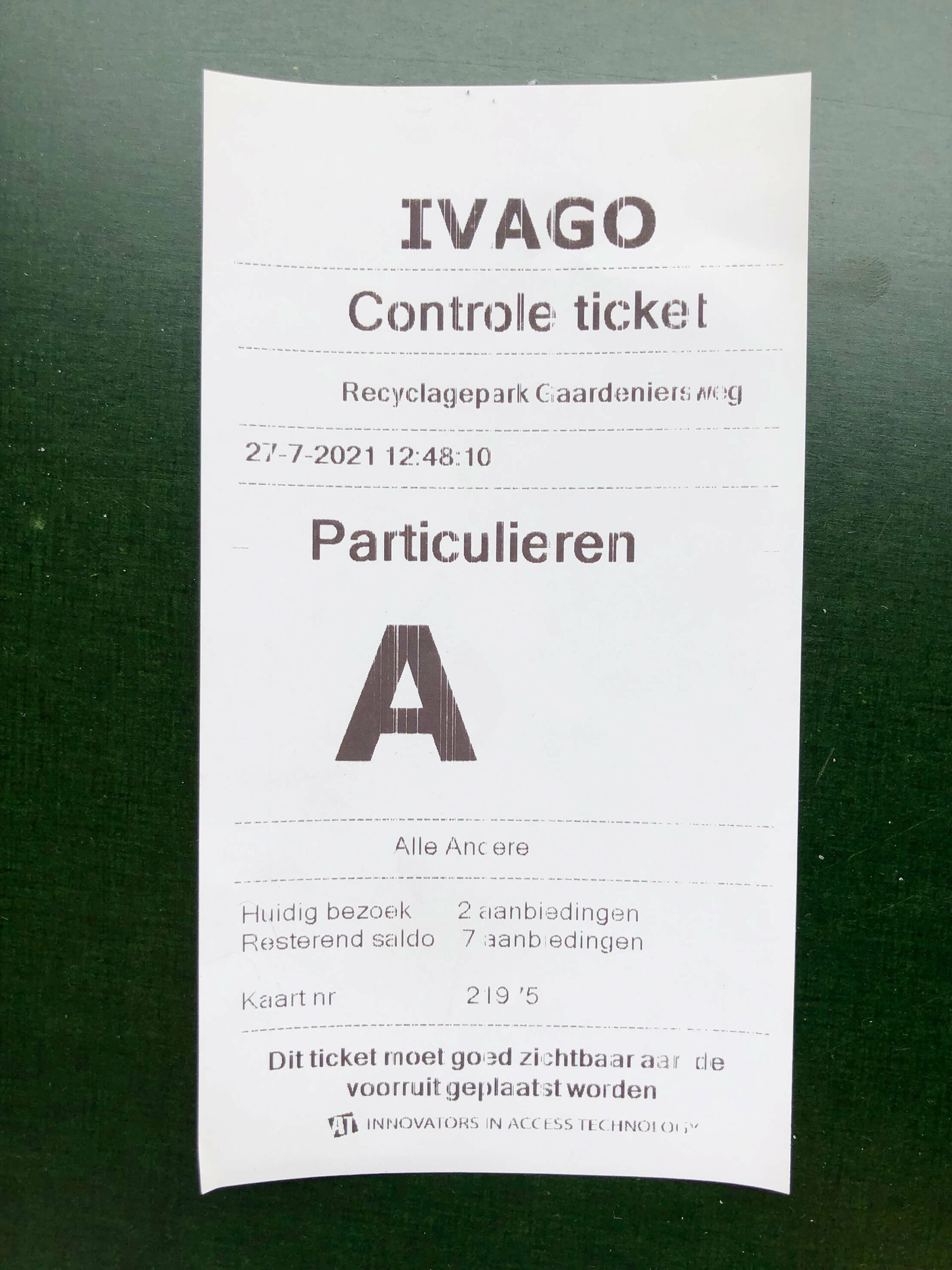
Today I brought an old bedspring, the styrofoam the air-humidifier came in, a few bags of sawdust and some scrap pieces of plywood to the municipal recycling center. As I was waiting to mount the stairs to the scrap metal container, a gray-haired man wearing blue leather shoes, dark jeans and a checkered shirt was tipping – with relative ease – a weight bench over the edge of the container.
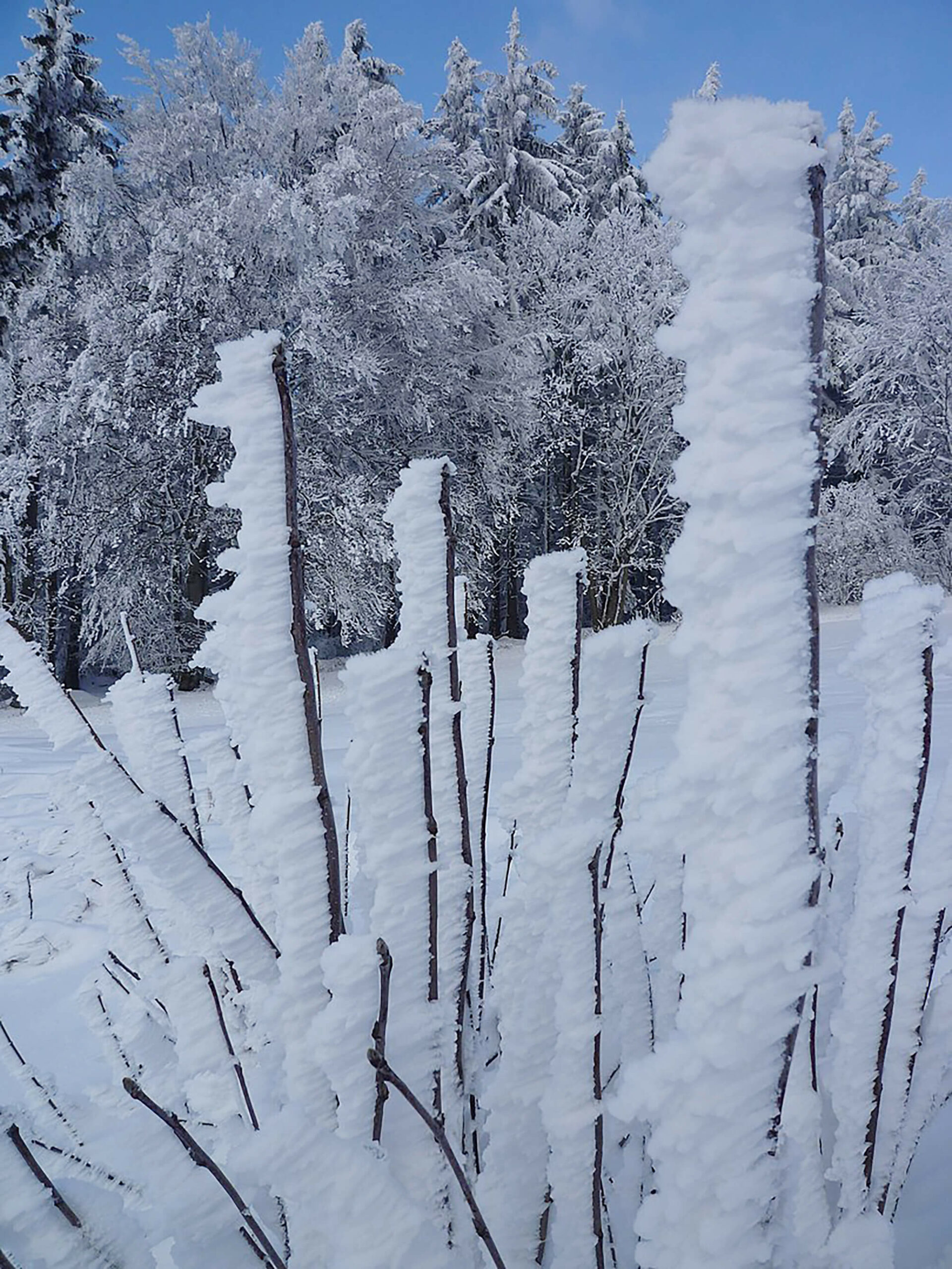
During the one day course Safety and Avalanches, teacher G.T. shows pictures of different manifestations of snow and ice. If one learns to read them, one can deduce the wind direction when hiking or skiing in mountainous terrain. Wind direction is crucial for assessing the stability of the snow. G.T.’s examples are of Austrian origin. He speaks about ‘Anraum’: displaced snow can get stacked horizontally against an object, such as a tree or a cross. The snow ‘grows and builds into the wind’. Counter-intuitively, the snow points to the side the wind is coming from. One can expect dangerous terrain in the direction of the ‘unbuilt’ side of the object.
Shortly after crossing the Thur the couple reaches their car. They’re freezing. As the sun sets they drive through the mountainous landscape. The heating hurts their fingers.
The next day, they return, but the scene looks different. It’s warmer. The Thur appears to flow faster.

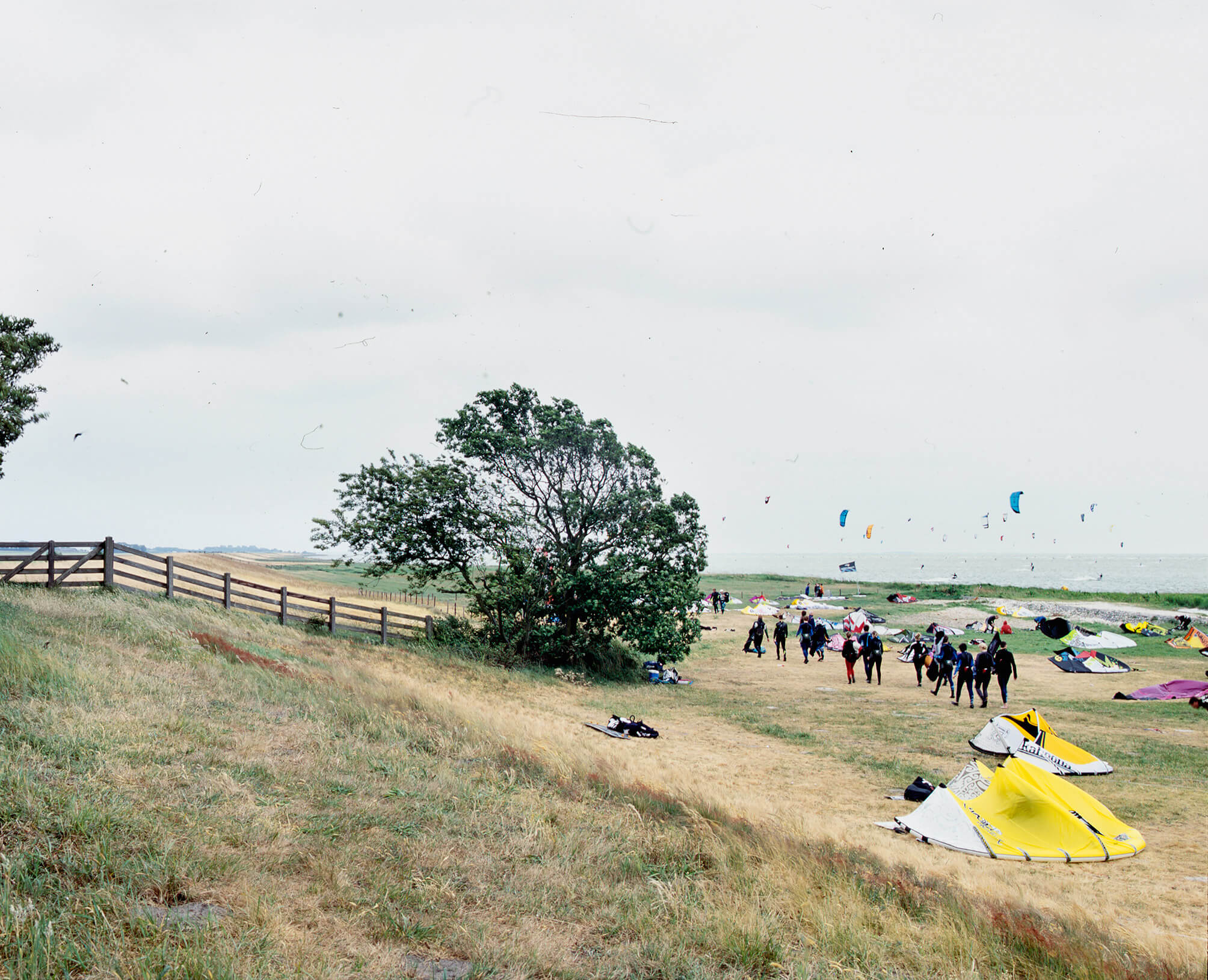
Ten years ago, in November, I drove up to Frisia – the northernmost province of The Netherlands. I was there to document the remains of air watchtowers: a network of 276 towers that were built in the fifties and sixties to warn the troops and population of possible aerial danger coming from the Soviet Union. It was very windy. The camera shook heavily. The poplars surrounding the concrete tower leaned heavily to one side.
I drove up to the seaside, a few kilometers farther. The wind was still strong when I reached the grassy dike that overlooked the kite-filled beach. I exposed the last piece of film left on the roll. Strong gusts of wind blew landwards.
Months later I didn’t bother to blow off the dust that had settled on the film before scanning it. A photograph without use, with low resolution, made for the sake of the archive’s completeness.
The dust on the film appears to be carried landwards, by the same gust of wind lifting the kites.
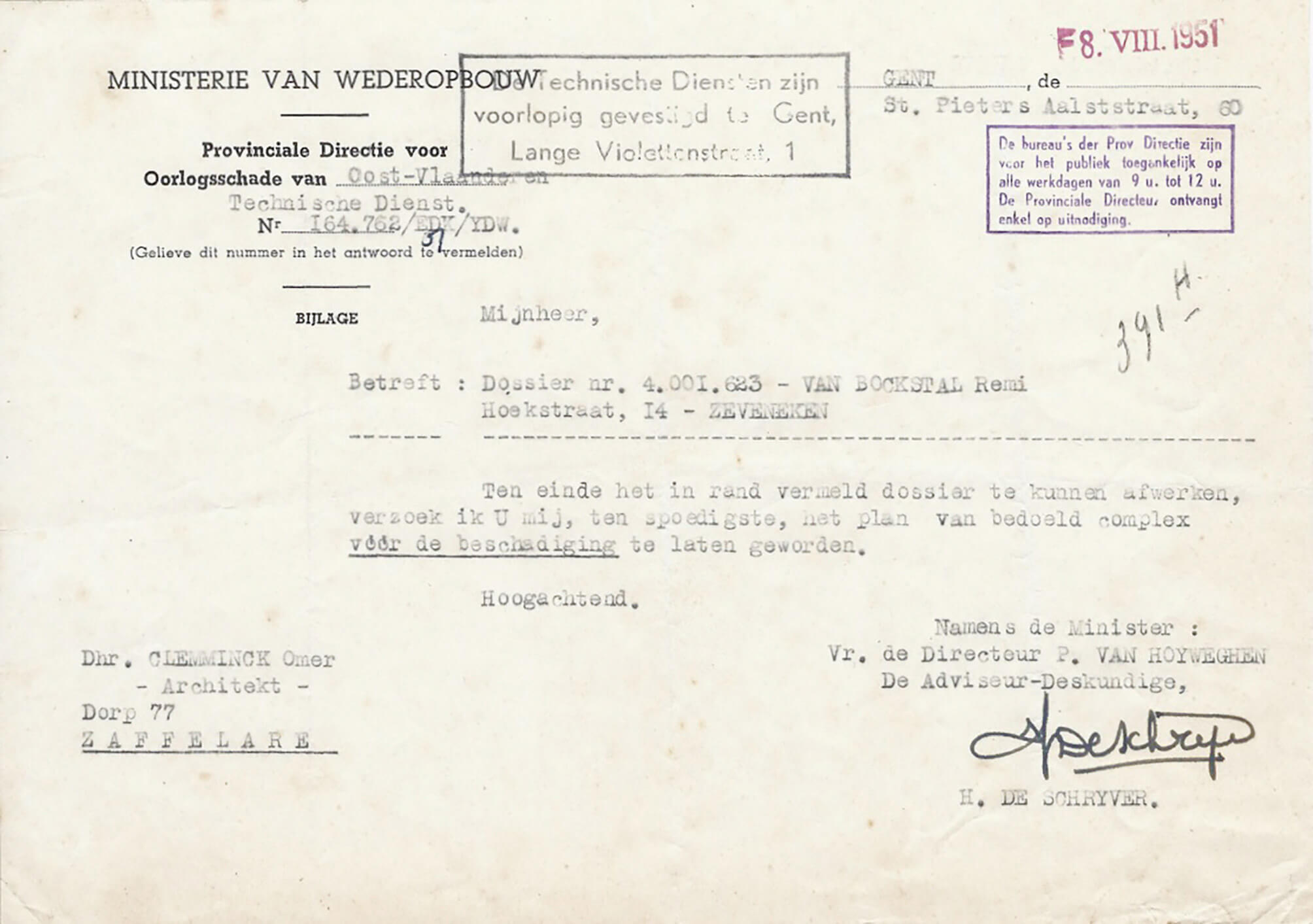
An architect in Z. receives a reminder. ‘Please send, as soon as possible, the plans of the construction before the damage.’ The reminder was sent by the Ministry of Reconstruction, in 1951. The architect’s address in Z., as mentioned in this file, is nowadays a house adjacent to Saloon Redbarn, a hall used for activities organized by a club of country and western-aficionados.
Semi-translucent paper, typoscript, stamps, handwritten notes and signature, from the archive of architect O. Clemminck, file ‘Remi Van Bockstael’
It’s early spring. The pool is covered with a sheet of plastic. The deciduous trees are just leafing out. A tree stump serves as a placeholder for the diving board’s foot – it was customary to take it indoors for winter – and keeps people from kicking its threaded rods sticking up from the silex tiles that line the pool.
The upper right corner of the plastic frame is missing. It’s probably where the insect – now dead, dry and yellowish – got in. The frame was left behind in the laundry room overlooking the garden, the pool and the pool house. At the time it hadn’t been used for quite a while. Half empty, the water green.
In summer, when the wind dropped, horse-flies came. You could shake them off temporarily by swimming a few meters underwater.

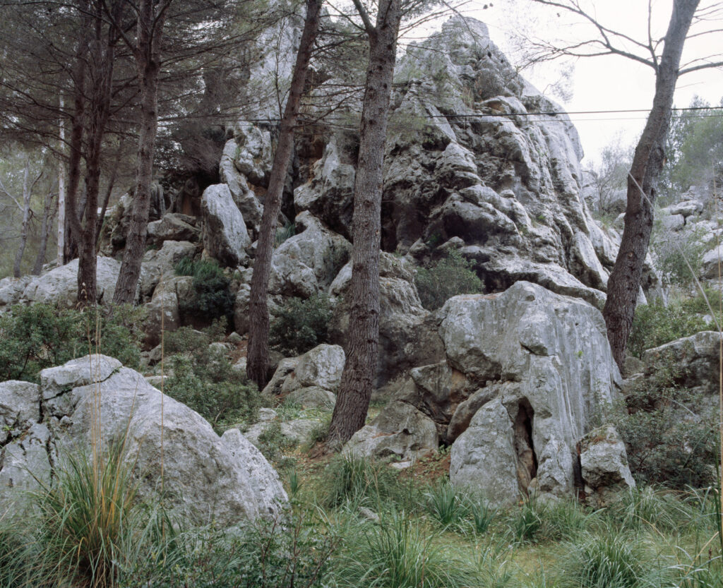
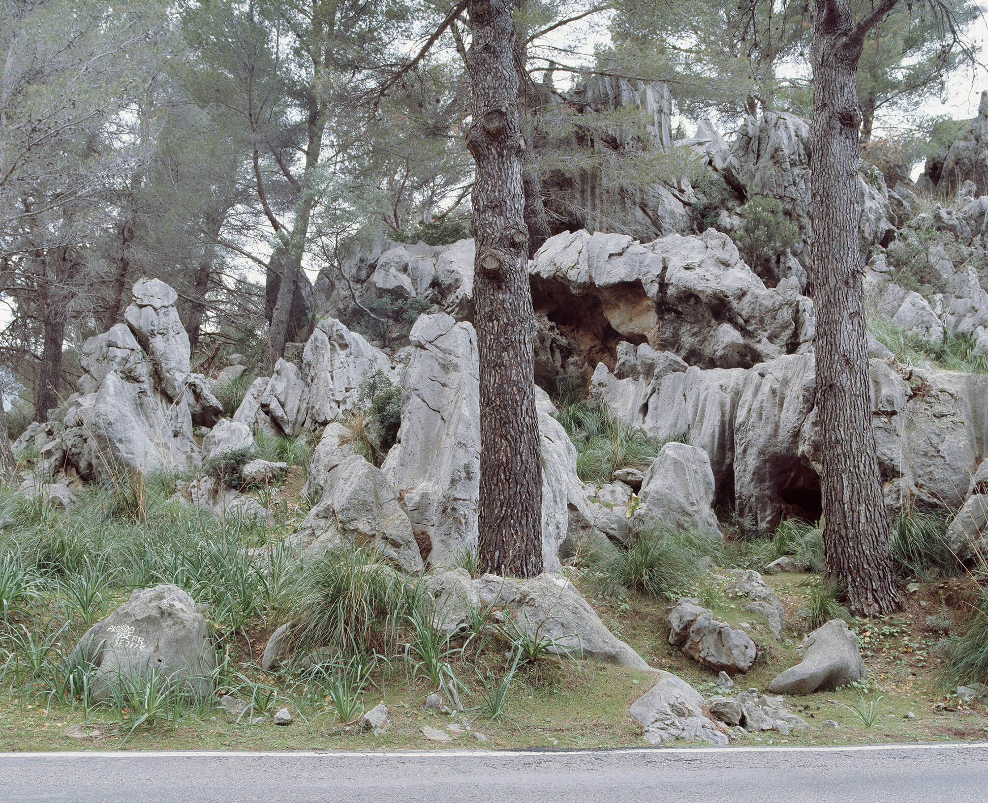
I must have driven past this rocky landscape about sixteen times, going back and forth between viewpoints and the house the parents of a friend let me stay in. On the last day, I left early for the airport, pulled into a lay-by, took my tripod and camera out of the trunk of the red Volkswagen Polo rental car and made two photographs.1 It was only when I got home, had the film developed, scanned it and was removing dust particles from the file, that I discovered the hand painted text on the rock: ‘PROIBIDO BUSCAR SETAS’.
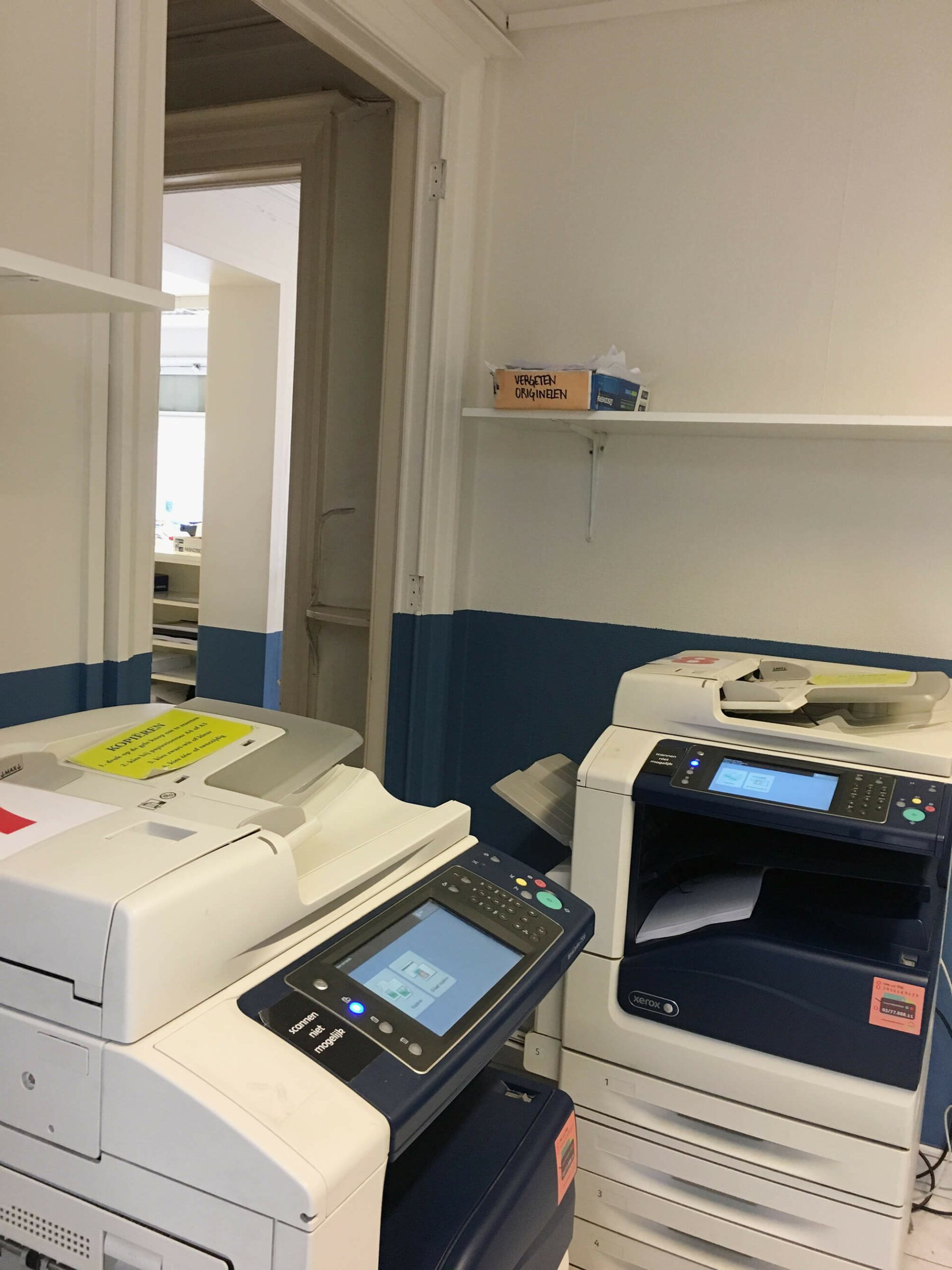
At the copyshop, on a shelf above photocopier 8, the lid of a box of paper serves as the container for ‘forgotten originals’.1
The book being copied: Didi-Huberman, G. La ressemblance par contact. Archéologie, anachronisme et modernité de l’empreinte. Paris: Les Editions de Minuit, 2008.
On May 23rd 2021, the planet Saturn appears to be stationary among the surrounding celestial bodies in the night sky.1 This is an attempt to capture this planetary standstill.2
A telescope is set up in a pasture, near a forest edge, pointed to the south-southeast morning sky.3
The standstill is de facto inexistent. It’s the moment when Saturn’s apparent prograde motion turns to a retrograde motion. Since Earth completes its orbit in a shorter period of time than the planets outside its orbit, it periodically overtakes them, like a faster car on a multi-lane highway. When this occurs, the planet being passed will first appear to stop its eastward drift, and then drift back toward the west.
In astrology, Saturn’s retrograde movement is generally a time of karmic rebalancing. Previous bad behavior could be punished. But hard work and responsibility could also be rewarded.
This is the third instalment of De Cleene De Cleene’s Public Observatory. Thanks to Volkssterrenwacht Mira, Grimbergen.
Briet, S. Qu’est-ce que la documentation? Paris: Edit, 1951.
Gittelman, L. Paper Knowledge. Toward a Media History of Documents. Durham/London: Duke University Press, 2014.
Oxford English Dictionary Online. Accessed on 13.05.2021.
‘Saturn Retrograde May 23, 2021 – Karmic Love’, Astrology King. Accessed on 15.05.2021.
